From flight planning to an exportable CAD/BIM file.

Five steps, one processing pipeline, one point of contact. You give us access to the site. We deliver the files to your teams.

Flight plans and authorizations handled before you arrive on site.

The Québec City region sits almost entirely within CYQB controlled airspace. We handle the NAV Drone request, notice to the site's prime contractor, and coordination with the site's CNESST prevention program.
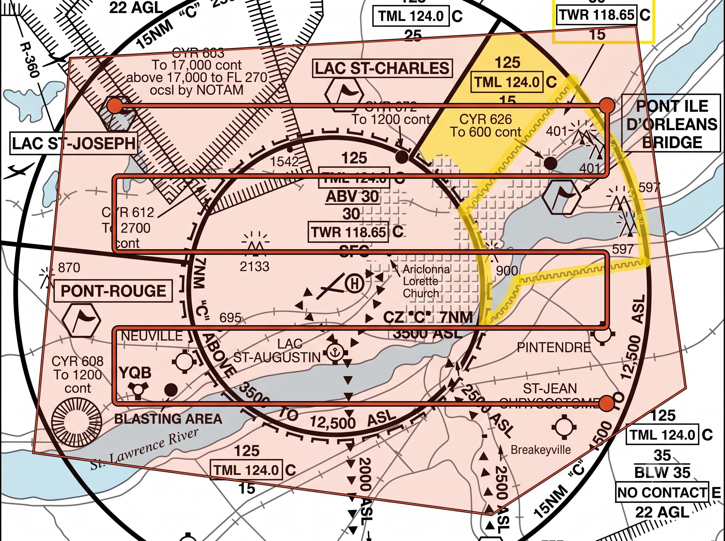
  • NAV CANADA authorization request via NAV Drone for every flight in CYQB airspace
  • Mission notice to the prime contractor and integration into the prevention program
  • Weather and airspace verification up to 24 hours before the flight
  • Municipal permits based on takeoff and landing zones
Flight planning map for controlled CYQB airspace

RTK capture and thermal imaging, without interrupting your ground operations.

The drone flies alongside heavy machinery. No site shutdown, no surveying crew to mobilize. Ground control points establish the accuracy you can prove to your clients.
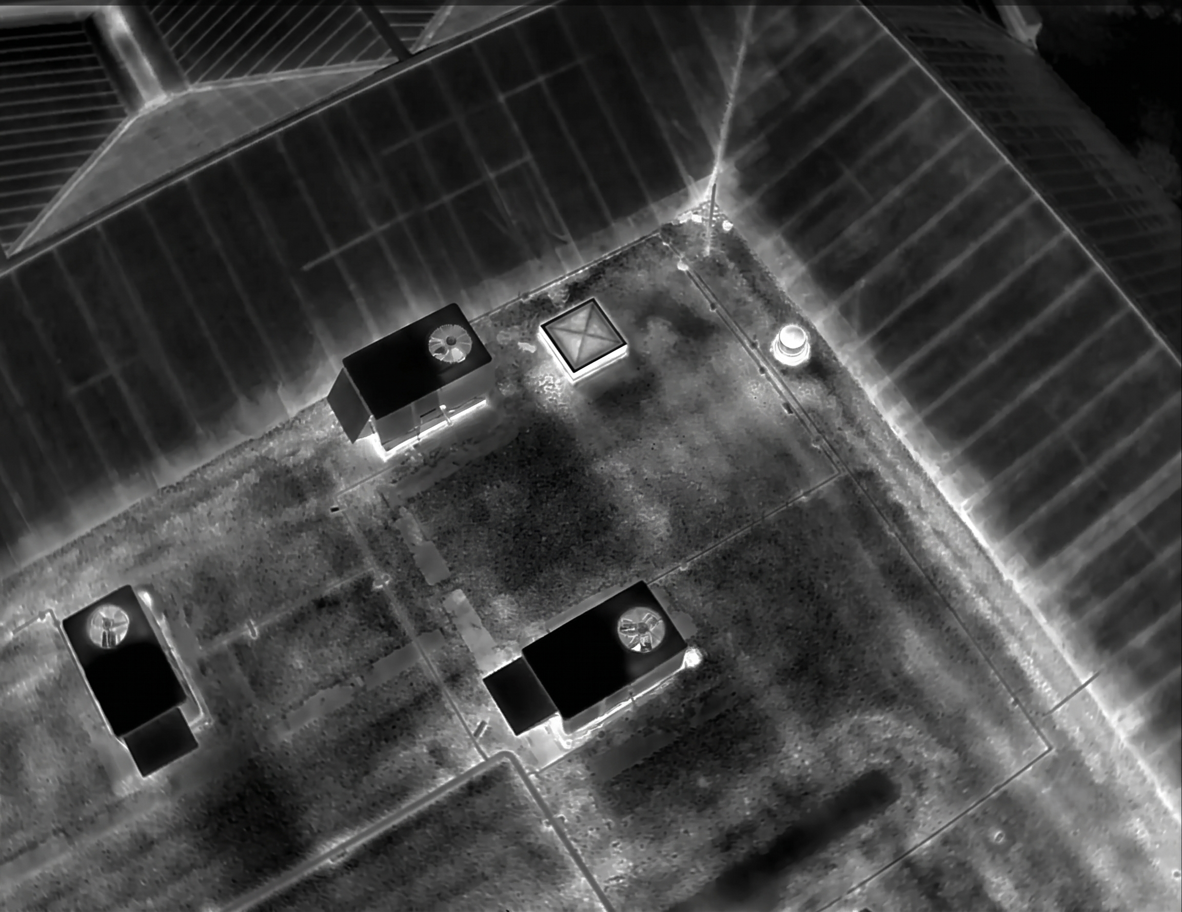
  • RTK flight with real-time corrections for centimeter-level accuracy
  • High-resolution RGB sensors, radiometric thermal as required by the mandate
  • Georeferenced ground control points (GCP) for verification
  • Advanced RPAS-certified pilot with visual observer on complex flights
Aerial thermal imaging of a roof captured by drone

Photogrammetry and point clouds delivered on a contractual deadline.

Our processing pipeline generates orthophotos, digital models, and point clouds within 48 hours of the flight. Miss the deadline, and an automatic 50% penalty applies to the invoice. It's in the contract.

  • Georeferenced orthophotos in NAD83 (CSRS), 2 to 5 cm/px resolution
  • Digital terrain models (DTM) and surface models (DSM)
  • Dense point clouds for precise volumetric calculations
  • Structured time-series comparisons, flight over flight
Point cloud · 487,200 pts/m² Export · .LAS · .OBJ · .GeoTIFF

Standardized reports and a web portal shared across your teams.

Your project managers open the portal, compare progress week over week, and measure a distance or volume directly on screen. No heavy file transfers, no software to install on the client side.

  • Secure web portal with access by project and by team
  • Before/after comparisons and a progress timeline slider
  • Annotations, measurements, and PDF report exports
  • Timestamped visual archive for dispute defense
altimetrix.ca/portail/projet-127 AVAILABLE FILES PROJECT TYPE DATE STATUS Beauport Site — Phase 2 Envelope Inspection Jun 28 Ready Lévis South Project Weekly Monitoring Jun 30 Ready Charlesbourg Site Point Cloud .LAS Jun 20 Ready Beauport Site — Phase 2 As-Built Plan .DWG Jul 1 Processing 3 active sites · 12 files available · 2 deliverables processing

Native exports for AutoCAD, Civil 3D, Revit, and BIM environments.

The government's 2021–2026 BIM roadmap mandates structured digital data. We export in the formats your engineers and architects open without an intermediate conversion, ready for the SQI's common data environment.

  • Open formats compatible with openBIM: .IFC, .LAS, .OBJ, .GeoTIFF
  • Absolute georeferencing via ground control points
  • 6,500+ published coordinate systems supported
  • SQI calibration compliant with Asset Information Requirements (AIR)
.IFC openBIM .LAS Point cloud .OBJ 3D model .DXF AutoCAD .GeoTIFF Orthophoto .RVT Revit Compliant · SQI BIM Roadmap · 2021–2026 NAD83(CSRS) · MTQ zone adapted to the site